Planning for Kinnaur from Delhi in August? Read This Before You Pack
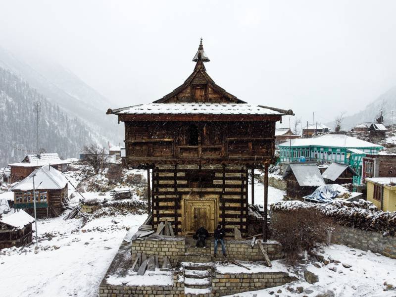
August in Kinnaur Valley is a time of striking contrasts. The lower Himalayas turn vibrant green, apple orchards in Sangla and Kalpa swell with ripening fruit, and mist hangs over the dramatic Sutlej River gorge. For mountain lovers, off-season quiet and rain-washed landscapes can sound like an ideal escape from Delhi's humid summer heat.
However, in your kinnaur trip from delhi (approx. 530–580 km via NH 44 and NH 5) during peak monsoon carries real logistical challenges. Heavy rainfall across lower and middle Himachal Pradesh brings frequent rockfalls, landslides, and road blockades along the Hindustan-Tibet Road (NH 5).
Before booking your trip or hitting the highway, here is what you need to know about weather risks, road conditions, route precautions, and safety protocols for visiting Kinnaur in August.
Key Takeaways
-
Weather Reality: August brings peak monsoon activity across Shimla, Solan, Mandi, and lower Kinnaur. Landslides and shooting stones are frequent along the NH 5 corridor.
-
Route Bottlenecks: Vulnerable sections include the overhangs at Tranda Dhank, stretches between Jeori, Tapri, Choling, and Karcham, where mudslides can stall traffic for hours or days.
-
Drive Safety: Avoid night driving entirely past Shimla or Rampur. Stick to early morning travel and build at least 2 buffer days into your itinerary.
-
Alternative Timing: If safety and clear views are your top priority, consider shifting your trip to September or October, which offers prime apple harvest season, stable weather, and open roads.
The Delhi to Kinnaur Route
To reach Kinnaur from Delhi by road, travelers follow the major northern corridor:
Delhi (NH 44) ➔ Chandigarh / Himalayan Expressway ➔ Shimla (NH 5) ➔ Narkanda ➔ Rampur Bushahr ➔ Jeori ➔ Karcham ➔ Sangla / Kalpa / Reckong Peo
| Leg | Approximate Distance | Typical Driving Time (Clear Weather) | August Monsoon Risk Level |
| Delhi to Chandigarh | ~245 km | 4–5 hours | Low (Smooth multi-lane NH 44) |
| Chandigarh to Shimla | ~115 km | 3.5–4.5 hours | Moderate (Occasional mudslides near Parwanoo / Solan) |
| Shimla to Rampur Bushahr | ~130 km | 4–5 hours | Moderate (Rain-soaked winding turns via Narkanda) |
| Rampur to Karcham / Reckong Peo | ~100 km | 4–6+ hours | High (Shooting stones, cliff overhangs, narrow rock cuts) |
| Karcham to Sangla / Chitkul | ~40 km | 2–3 hours | High (Unpaved patches, slush, prone to local stream overflow) |
4 Crucial Challenges of Traveling to Kinnaur in August
1. Shooting Stones & Cliff Overhangs on NH 5
The section of the old Hindustan-Tibet Road cut into vertical rock faces above the Sutlej River—particularly around Tranda Dhank, Powari, and Choling—is infamous for shooting stones during rainstorms. Even moderate rainfall can dislodge loose boulders from high cliffs, making driving hazardous.
2. Sudden Road Closures & Debris Flows
The Himachal Pradesh State Emergency Operation Centre (SEOC) routinely reports temporary closures on mountain highways during August due to debris flows. While road clearance agencies (like the Border Roads Organisation) deploy heavy machinery quickly, clearing a major landslide can take anywhere from a few hours to a full day.
3. Silt-Laden Rivers & Hydroelectric Dam Releases
In August, the Sutlej and Baspa rivers swell with glacier melt and monsoon run-off. Water levels in reservoirs rise rapidly, leading to periodic water releases from dams like Nathpa Jhakri and Karcham Wangtoo. Stay away from riverbanks and low-lying bridges throughout the valley.
4. Poor Visibility & Mountain Fog
Dense fog often settles over high-altitude passes like Narkanda and the ascent toward Kalpa during active rain spells. This drastically reduces visibility on narrow two-lane roads without guardrails.
Essential Travel Checklist if You Go in August
If your travel dates in August are fixed, take these essential precautions to ensure a safer trip:
-
Track Official Updates Daily: Check same-day status reports from the Himachal Pradesh Police (HPP) and the State Emergency Operation Centre (SEOC) before setting off each morning.
-
Never Drive After Dark: Plan your driving hours strictly between 6:00 AM and 5:00 PM. Nighttime driving significantly increases the risk of hitting fallen rocks or unseen washouts.
-
Carry Extra Emergency Supplies: Keep a thermal flask, dry foods/snacks, emergency water, a first-aid kit, fully charged power banks, and basic tools in your vehicle in case you get delayed at a road blockade.
-
Maintain Flexible Accommodations: Avoid non-refundable hotel bookings. If a landslide forces you to halt at Rampur, Jeori, or Sarahan, flexible bookings allow you to adapt without financial penalties.
-
Break the Journey Overnight: Never attempt Delhi to Kinnaur in a single day. Halt overnight at Narkanda, Rampur, or Sarahan before tackling the narrow upper valley sections.
When is the Ideal Time to Visit Kinnaur?
If you prefer stable road conditions and blue skies, consider shifting your itinerary:
-
September to October (Autumn/Harvest): The monsoon recedes, roads dry out, skies clear up to reveal dramatic snow-peaks, and Kinnaur's world-famous apple orchards reach full harvest.
-
April to June (Late Spring/Summer): Pleasant weather (15°C to 25°C), blooming flora, clear road conditions, and accessible high-altitude passes.
Frequently Asked Questions
Is the road from Delhi to Kinnaur safe in August?
While NH 44 up to Chandigarh is a smooth 4-lane expressway, mountain roads past Shimla on NH 5 become high-risk during August due to monsoon-induced landslides, mudslides, and shooting stones. Travel is possible, but requires caution, flexible schedules, and daytime driving.
Are public HRTC buses running from Delhi/Shimla to Kinnaur during monsoon?
Yes, HRTC (Himachal Road Transport Corporation) operates daily bus services connecting ISBT Kashmiri Gate in Delhi and ISBT Shimla to Reckong Peo and Sangla. However, schedules can be delayed or temporarily suspended during major landslide blockages.
Can I visit Chitkul and Sangla in August?
Sangla Valley and Chitkul (the last Indian village near the Indo-Tibet border) are accessible by road, but the Karcham-to-Sangla stretch can become very muddy and rough during heavy rains. Always verify local road conditions at Karcham dam before turning into the valley.
References & Authoritative Sources
-
Himachal Pradesh State Emergency Operation Centre (SEOC) & Disaster Management Authority: Real-time state road closures, weather advisories, and emergency contact details. https://hpsdma.nic.in/
-
India Meteorological Department (IMD) – Regional Meteorological Centre Shimla: Official district-level monsoon weather forecasts and warnings for Himachal Pradesh. https://mausam.imd.gov.in/shimla/
-
Ministry of Road Transport & Highways (MoRTH) / Border Roads Organisation (BRO): Highway maintenance and status updates for National Highway 5 (NH 5). https://morth.nic.in/