Safe Places to Visit in Himachal During Monsoon 2026
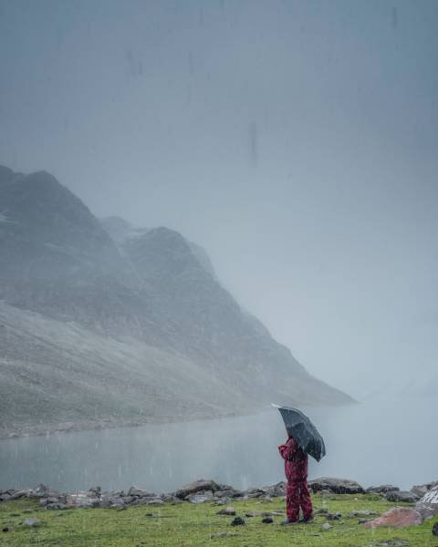
The monsoon transforms Himachal Pradesh into a lush, emerald paradise, but navigating the mountains during this time demands careful planning. A safe and memorable experience relies on tracking actual regional climate data rather than making general assumptions.
The normal average rainfall for the southwest monsoon season (June to September) across the state of Himachal Pradesh is officially calculated at 734.4 mm [1]. However, mountain geography creates distinct microclimates. While lower-altitude valleys face heavy precipitation and structural risks, specific rain-shadow zones and well-connected ridge towns offer safer, highly stable getaways.
1. Spiti Valley: The Rain-Shadow Sanctuary
If you want to completely bypass the monsoon risk, the high-altitude cold desert of the Spiti Valley is the safest choice.
The Data Proof
Spiti lies directly in the trans-Himalayan rain-shadow zone. The towering Pir Panjal and Great Himalayan ranges physically block the moisture-laden monsoon winds from entering the valley. Official baseline climate records show that while a high-exposure district like Kangra receives a massive 1,622.4 mm of normal seasonal monsoon rainfall, the Lahaul and Spiti district's normal baseline sits at a fraction of that—just 382.9 mm for the entire four-month season [1].
The Perspective
The monsoon season is actually considered prime time to visit Spiti. Towns like Kaza, Dhankar, and Tabo experience clear skies and completely dry conditions while the rest of the country sees heavy downpours. You can safely explore centuries-old monasteries like Key Gompa and the world's highest post office at Hikkim without the threat of rain-induced landslides.
Critical Transit Note
Travelers heading to Spiti should choose the Shimla–Kinnaur–Kaza route (National Highway 5). This approach offers a gradual, structurally stable incline compared to the western passes like Gramphu, which remain highly unstable during early season transitions.
2. Kasauli: The Stable Gateway Ridge
For travelers who want a classic, misty monsoon experience without the risks of deep-mountain driving, the cantonment town of Kasauli stands out as an incredibly safe option.
The Data Proof
Kasauli is situated in Solan district, which features a normal seasonal monsoon rainfall baseline of 874.3 mm [1]. Because Kasauli is located on a steady, heavily forested ridge line rather than a steep river valley, it lacks the deep gorges that typically cause massive soil displacement and heavy runoff.
The Perspective
Kasauli allows you to experience the authentic charm of a Himalayan monsoon—cobblestone streets, low-hanging clouds, and damp pine forests—with minimal transit risk. Because it sits just off the Himalayan Expressway, you avoid the narrow, winding inner-state highways that are prone to rockfalls. It provides a peaceful retreat centered around quiet walks to the Christ Church and colonial-era vantage points.
3. Dalhousie: The Protected Foothill Retreat
Perched across five hills on the western edge of the Dhauladhar mountain range, Dalhousie offers a safe, highly scenic monsoon experience.
The Data Proof
Dalhousie sits in Chamba district, where the baseline monsoon rainfall is registered at 853.4 mm [1]. While northern pockets of Chamba receive higher concentrated rainfall, the southern foothills housing Dalhousie remain protected. The town features excellent, decades-old drainage infrastructure dating back to its establishment as a sanitarium town, preventing water logging and road erosion.
The Perspective
During the rains, the nearby meadows of Khajjiar turn an intense, vibrant green, and the deodar forests of the Kalatop Wildlife Sanctuary are frequently enveloped in beautiful mist. The primary highways connecting Pathankot to Dalhousie are wide and historically more resilient against sudden road breaches than the central river corridors of the state.
The 2026 Monsoon Safety Framework
To ensure your journey aligns with official safety guidelines, implement this strategic transit framework before and during your trip:
-
Monitor Micro-Forecasts Daily: Avoid relying on broad, state-wide weather updates. Check the micro-climate feeds for your specific destination town. Intense localized downpours can happen even during a low-average monsoon season.
-
Maintain River and Reservoir Buffers: It is strictly advised against camping, parking, or walking near active riverbeds, including the Beas, Sutlej, and Ravi rivers. Upstream hydroelectric dams frequently open their floodgates with very little warning to manage high-altitude glacial run-off.
-
Enforce Diurnal Travel Restrictions: Avoid driving through mountainous stretches after dark. Heavy downpours dramatically reduce visibility, making it impossible to spot loose rocks or "shooting stones" on the road surface.
-
Verify Accommodations: Ensure you book your stay exclusively with guest houses or properties registered under the local tourism department. Registered properties are subject to structural safety audits and are directly tied into local emergency administrative networks.
If you are planning a Himachal trip in July but feel hesitant about navigating the unpredictable himachal weather in july, let our local expertise put your mind at ease. As a native, Himachal-based travel firm with decades of on-ground experience tracking regional microclimates and road conditions, we at Himachal Tourism Travel are uniquely equipped to design a safe, structurally sound, and deeply memorable journey tailored entirely around the season's safest corridors.
Data Sources & References
-
[1] India Meteorological Department (IMD), Meteorological Centre Shimla, Ministry of Earth Sciences, Government of India. Official District-wise Monsoon Normal Rainfall Database (Long Period Average Baseline). https://mausam.imd.gov.in/shimla/